
Permafrost and rock glaciers
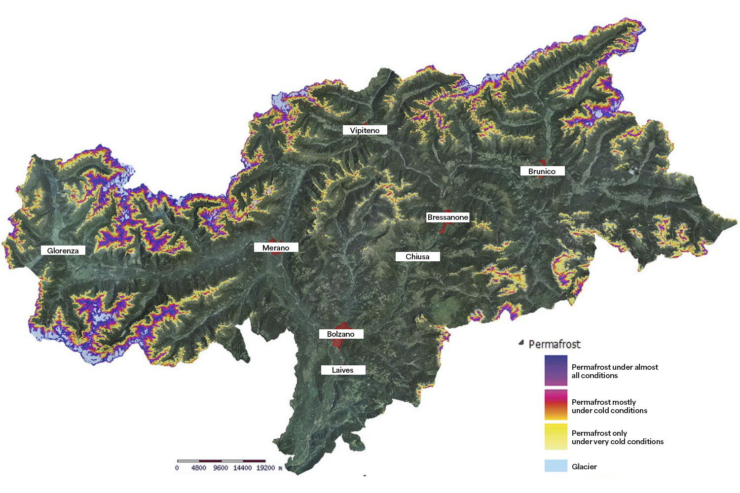
Permafrost refers to soil and rock that remain below 0 °C for at least two consecutive years. In the Alps, it typically occurs at elevations above 2,500 meters. Within these frozen layers, ice can accumulate either mixed with mineral soil components or filling cavities and fractures. Continuous freeze–thaw cycles, melting of ground ice, and its plastic deformation cause surface changes, slope movements, and landslides.
2
Closely linked to permafrost are rock glaciers. These are flows of debris and boulders held together by interstitial ice, creeping slowly downhill under their own weight – much like glaciers. Rock glaciers also consist of two main zones:
the accumulation zone, where ice can form even in summer thanks to cooling effects created by air circulation among the rocks,
and the ablation zone, further downslope, where higher temperatures cause the ice to melt during summer.
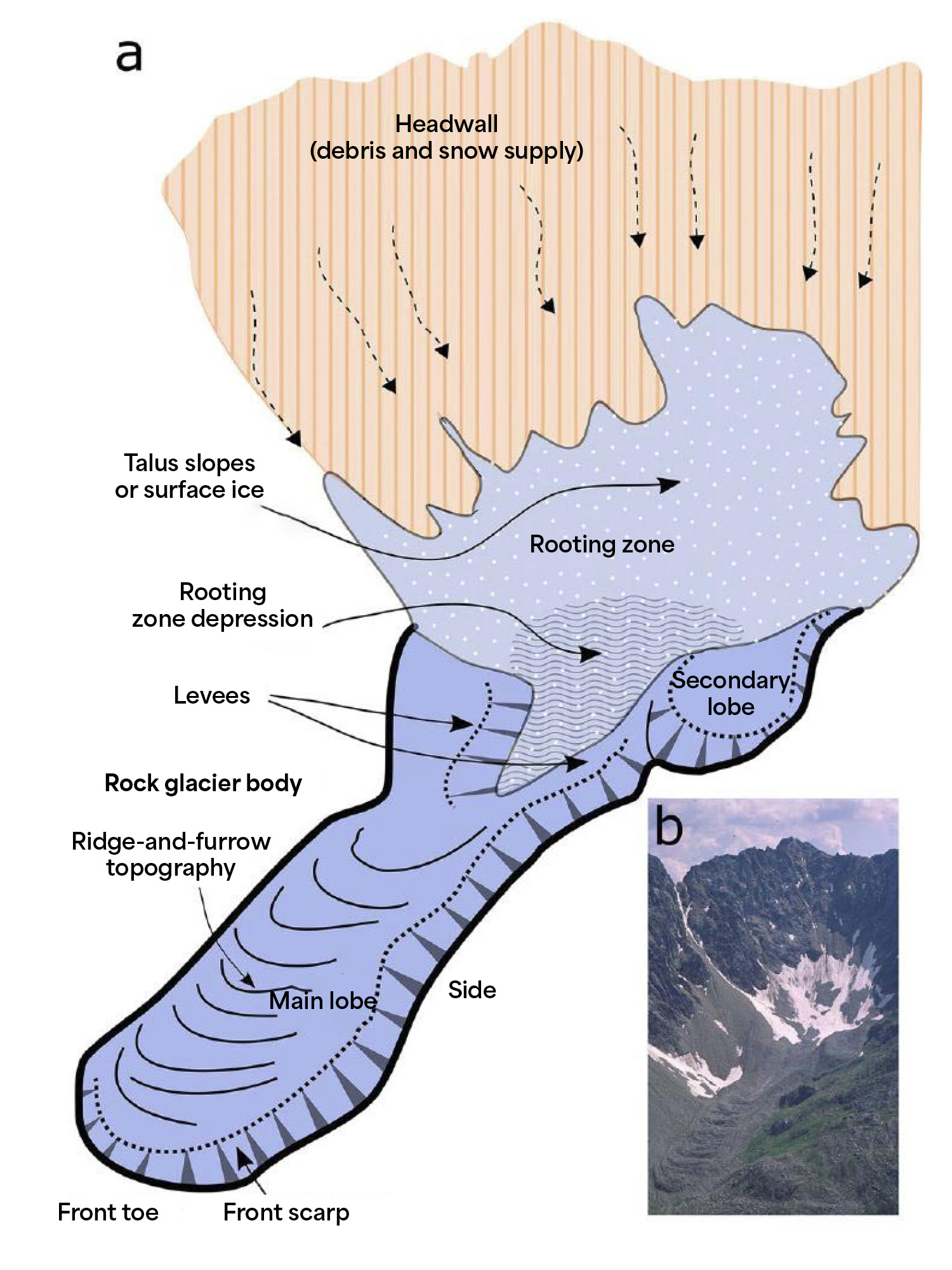
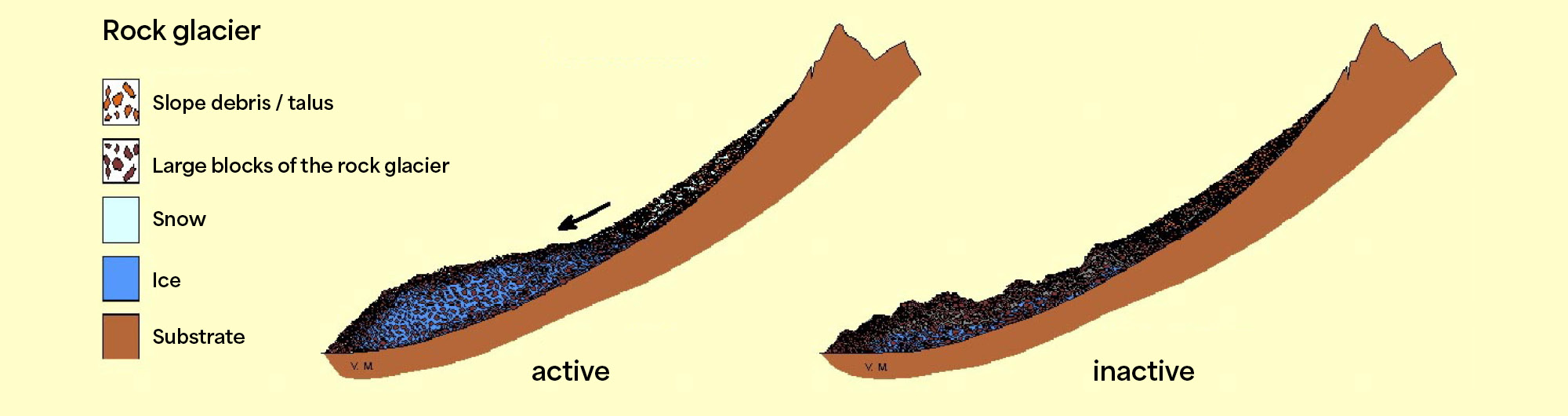
Rock glaciers move much more slowly than ice glaciers, yet they can reach impressive sizes. They are also important climate archives: by studying and monitoring their movements, scientists can trace the history of temperature changes in alpine environments.
Legend
Green dashed line: Glacier extent in 2007
Green line: Little Ice Age moraine (maximum glacier extent around 1870)
Red line: Rossbänke rock glacier – active, moving zone
Blue line: Rossbänke rock glacier – inactive zone with ice and minimal movement
Dark green line: Rossbänke rock glacier – fossil zone without ice
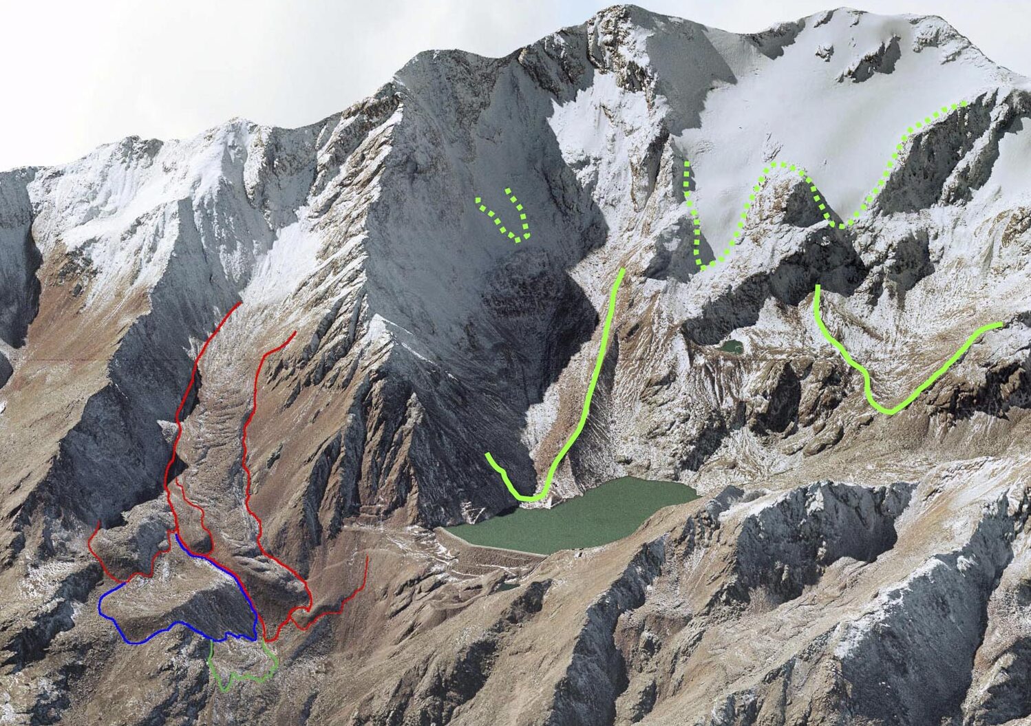
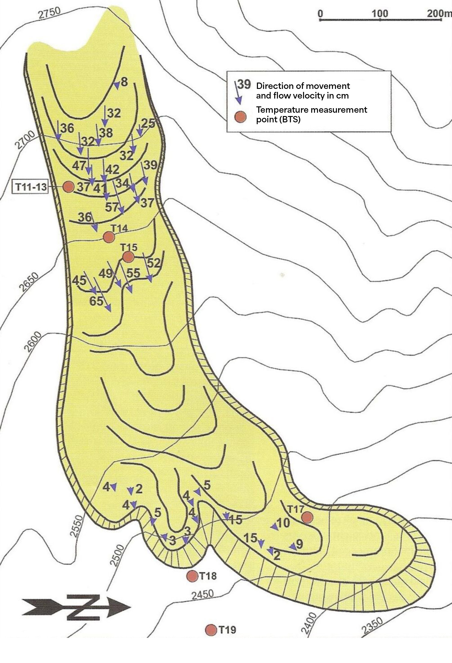
Map of rock glacier movements
Mean flow velocity: 30 cm per year
Interferometry
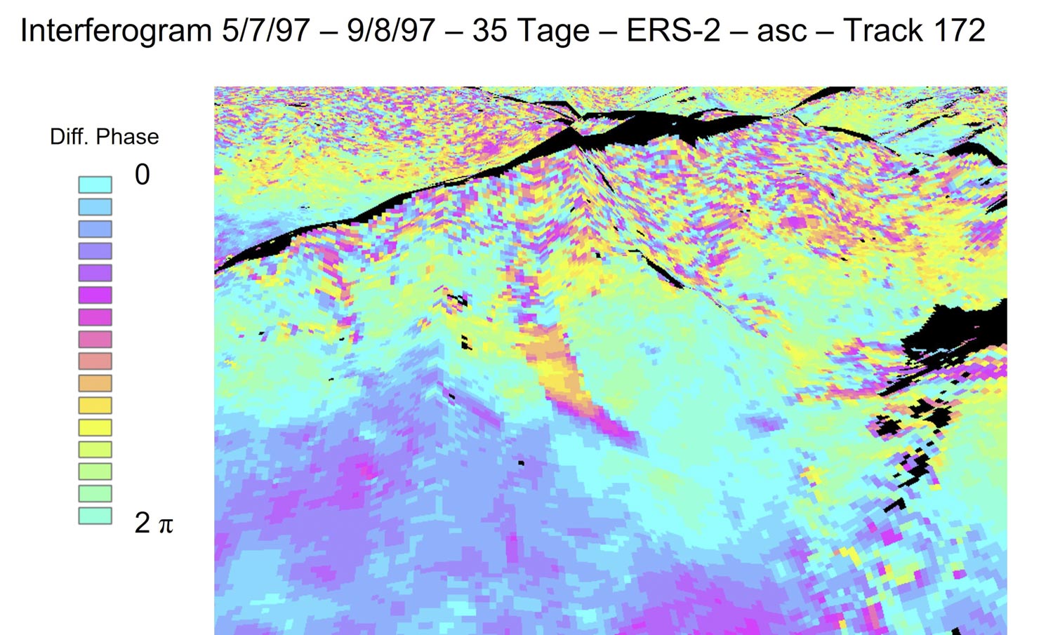
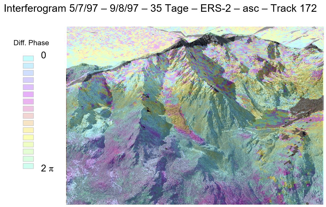
Satellite interferometry measures the differences between two images acquired by a satellite over the same area at different times. This principle is illustrated in a simplified way in the figure. The satellite emits a signal whose phase (wave position) depends on the distance between the satellite and the ground surface. If the ground moves, this distance changes, resulting in a change in the signal phase. This phase difference can be measured. Using this method, it is possible to detect whether rock glaciers are moving and to quantify their movement with high precision.
Pian dei Cavalli rock glacier
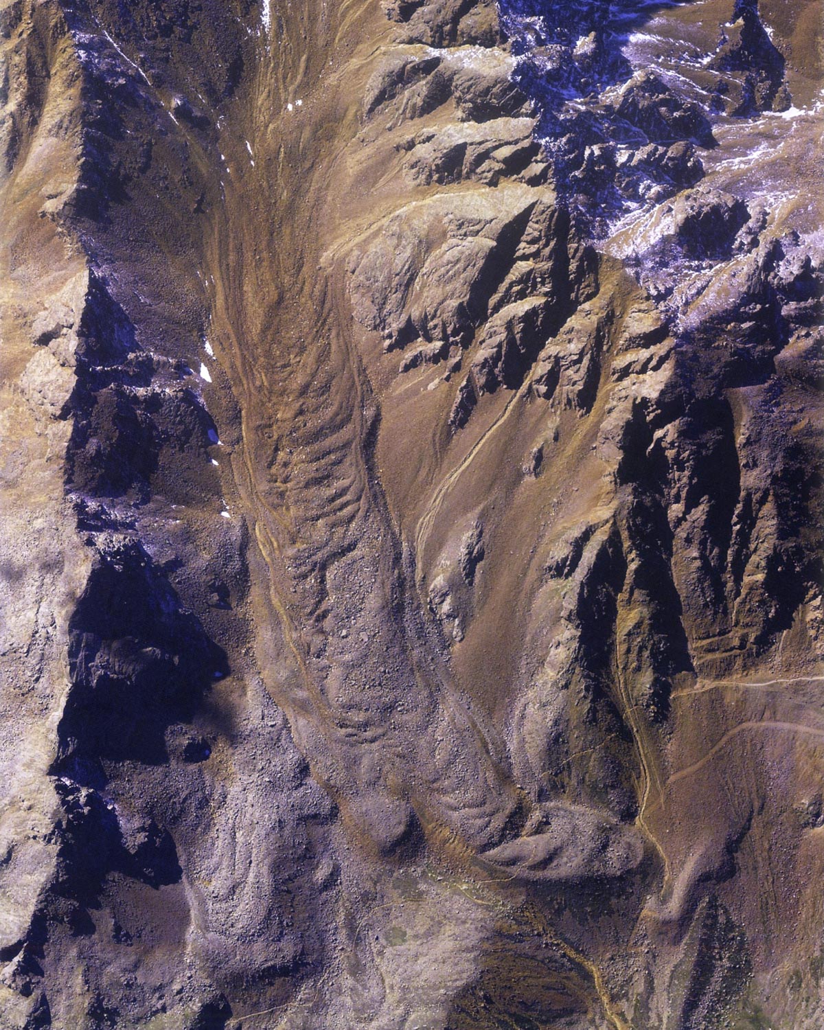
A striking example is the Pian dei Cavalli rock glacier, one of the largest in South Tyrol. It measures about 1,380 metres in length, up to 230 metres in width and 60 metres in depth. It is divided into several tongues, each moving at different speeds: the lowest tongue is almost stable, while the one just above the hiking trail advances much faster. Between 2015 and 2025, its average velocity increased from 30–60 cm per year to around 90–120 cm – clear evidence of global climate warming.